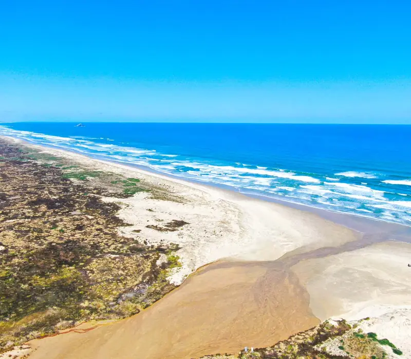
This is the Ninety Mile Beach in Northland, New Zealand, not the one in Gippsland. It is a single straight run of hard sand on the Tasman Sea coast of the Far North, from Ahipara, 14 km from Kaitaia, up to Scott Point, 5 km short of Cape Maria van Diemen. It is 88 km long, about 55 miles, and it is legally a public road. There is almost nothing built on it: surf on one side, low dunes and the pine plantation of the Aupōuri Forest on the other, and the big sand hills of Te Paki at the top end. Most people see it on the way to Cape Reinga, the northern tip of the country.
Of the itineraries we sell, 30 include Ninety Mile Beach. Almost all of them do it the same way: a full day out of Paihia or Kerikeri in the Bay of Islands on a coach built to drive on sand, with Cape Reinga at one end of the day and the beach, the Te Paki dunes and a fish and chip stop on the way back. None of them has you sleeping beside the beach; this is a day trip from a base further south, and for most people that is the right call.
- From Kaitaia (to Ahipara)
- 14 km, about 15 min
- From Paihia (to Cape Reinga)
- 210 km, about 3 h 30
- From Auckland (to Kaitaia)
- 315 km, about 4 h 30
- Nearest airports
- Kaitaia (KAT), Barrier Air from Auckland, Bay of Islands, Kerikeri (KKE), about 3 h to Cape Reinga by road
Why Ninety Mile Beach is only 55 miles long
Nobody is sure who named it, but the usual explanation is that early European travellers took three days to ride it on horseback. A horse covered about 30 miles a day on a road, so three days made ninety miles. On soft sand, with tides to wait out, the horses were far slower than that, and the beach is really 88 km. The name stuck anyway, and the question of why it is wrong is the one we get most often.
The Māori name is Te Oneroa-a-Tōhē, the long beach of Tōhē. Tōhē was an ancestor of Ngāti Kurī, the iwi of the far north. The beach leads to Te Rerenga Wairua, the headland at Cape Reinga where, in Māori tradition, the spirits of the dead leave for the homeland of Hawaiki. That is the reason the cape matters so much, and why there are rules about eating there (below).
In the early 1930s the hard sand served as a runway for some of the first airmail flights between Australia and New Zealand, and since 2011 the beach has been part of Te Araroa, the trail that runs the length of the country. Walkers doing the whole trail start at Cape Reinga and spend their first few days on this sand.
Can you drive on Ninety Mile Beach?
Yes, in the right vehicle, at the right time. The beach is officially a highway, and it still serves as a back road when State Highway 1 north of Kaitaia is closed by slips or flooding. But it is a highway with no seal, no signs and a tide that covers it twice a day. Only four wheel drives should go on it, only in the hours either side of low tide, and only with someone who knows where the soft patches and the stream crossings are. Cars that get the timing wrong end up stuck in the wet sand with the sea coming in, and some are not recovered.
The rule that matters most to visitors: rental companies do not allow their cars on the sand. So on a self drive holiday you drive the sealed road up State Highway 1 to Cape Reinga, and if you want the beach itself you book a seat on one of the sand coaches out of Kaitaia or Paihia for the day.
The coaches are the reason most of our guests get onto the beach at all. They are high clearance buses, driven by people who do the run most days, and they time the trip to the tide. On a typical day they go up the beach and come back by the highway, or the reverse, depending on when low water falls. Te Paki Stream, at the northern end, is the usual way on or off: the coach drives down the shallow stream bed between the dunes and out onto the sand.
Things to do on Ninety Mile Beach
- Slide the Te Paki dunes: the giant dunes at the northern end are high enough that the run down on a board or toboggan is quick and hard to stop. The climb up is the harder part. The coach tours include it, and DOC notes boards can be hired locally.
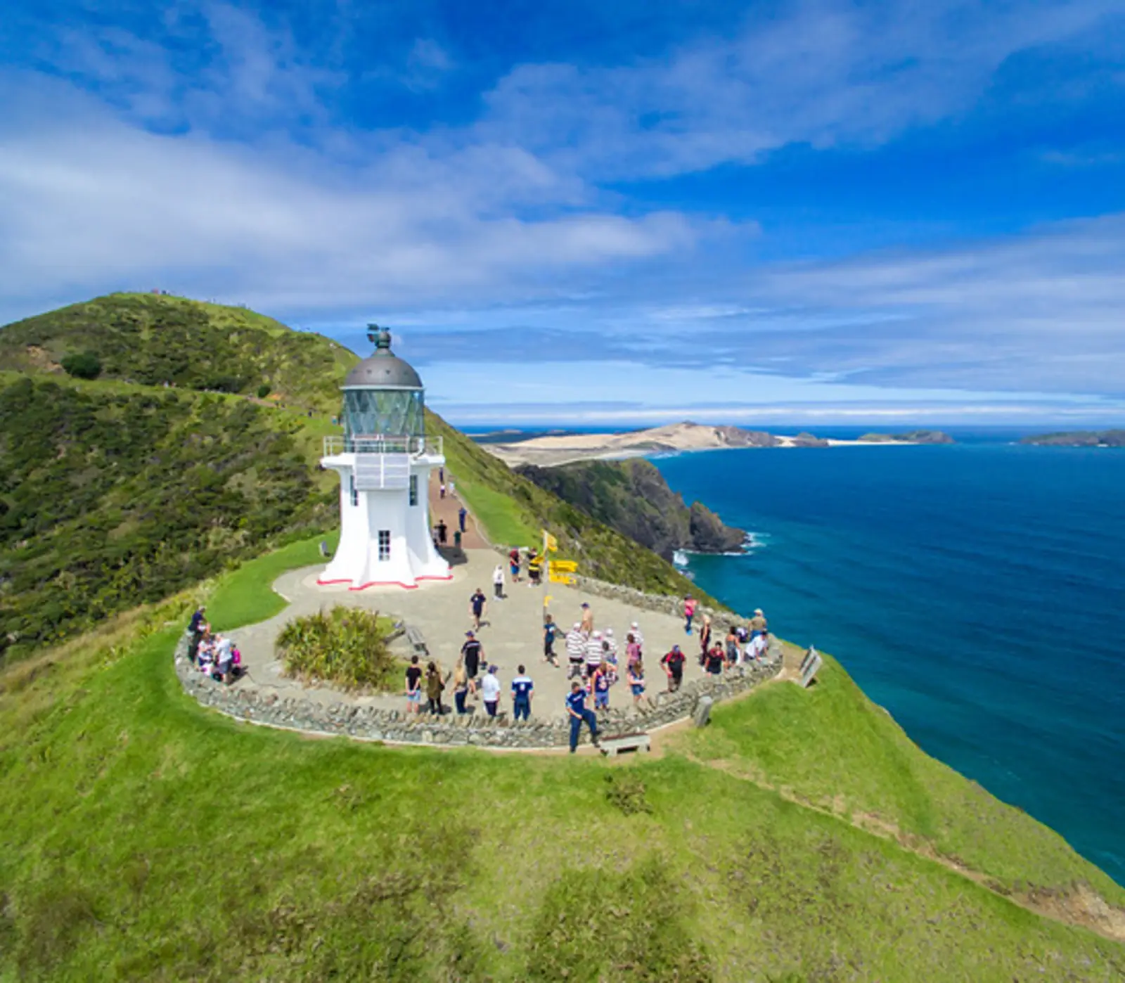
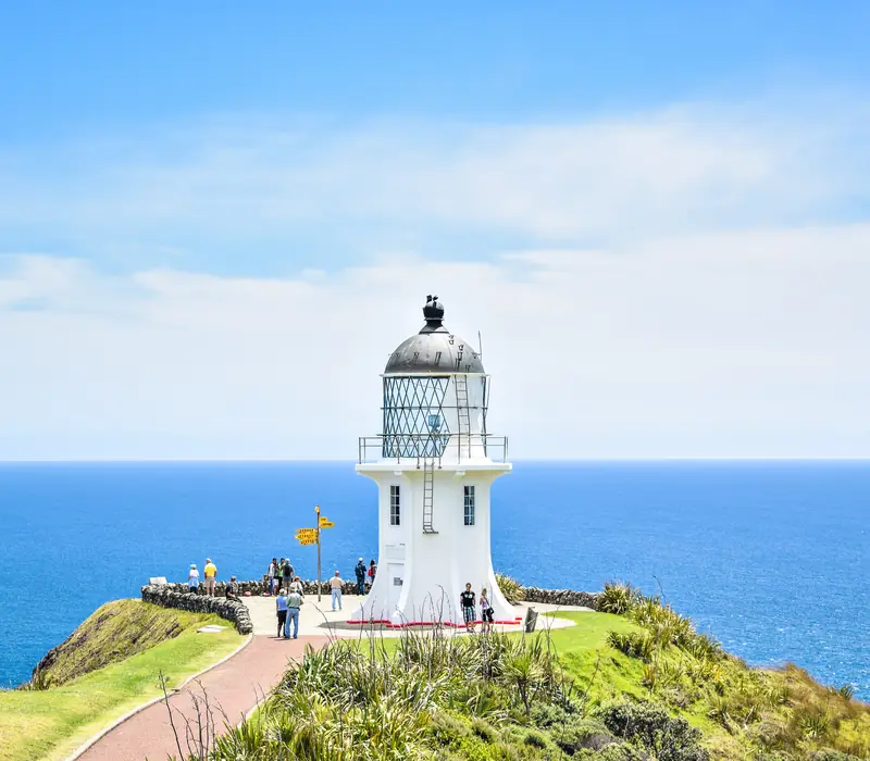
- Cape Reinga / Te Rerenga Wairua: the lighthouse at the tip, first lit in 1941, is a short walk down from the car park, with the Tasman Sea and the Pacific Ocean meeting in a line of broken water over the Columbia Bank below. It is a sacred site: no food may be eaten there (water is fine), no dogs, no camping.
- Dig for tuatua: at low tide you can feel for these small surf clams with your feet in the wet sand. Check the current Fisheries New Zealand daily limit before you take any. The larger toheroa, which the beach was once famous for, is protected.
- Surf at Ahipara: the southern end has Shipwreck Bay, a long left hand point break that surfers travel a long way for. It needs a decent swell; on a flat day it is a pretty bay with a rusting wreck at low tide.
- Fish: surfcasters line the beach in summer, and a five day snapper fishing contest is held every year in late February or early March, with anglers spread along the whole length.
- Walk it: even an hour on the empty sand at Ahipara or at Waipapakauri gives you a sense of scale that the coach window does not.
Our guides cover the rest of the region: the Bay of Islands guide for where to base, and the best beaches in New Zealand if you are weighing this one against the Coromandel or Abel Tasman.
How to get to Ninety Mile Beach
The beach runs parallel to State Highway 1 for most of its length, with the Aupōuri Forest in between. Kaitaia, a town of about 6,000 people, is the last place with a proper supermarket and a choice of fuel. From there it is 14 km to Ahipara at the southern end, and 111 km up the highway to Cape Reinga. From the Bay of Islands the drive to the cape is about 210 km, three hours or more each way, which is why the day tours leave early.
| From | Distance | Driving time | How our tours do it |
|---|---|---|---|
| Kaitaia to Ahipara | 14 km | About 15 min | Self drive; the start of the beach |
| Kaitaia to Cape Reinga | 111 km | About 1 h 45 | Sand coaches also run from here |
| Paihia to Cape Reinga | 210 km | About 3 h 30 each way | The full day coach tour most of our itineraries include |
| Auckland to Kaitaia | 315 km | About 4 h 30 | Self drive only; most people break the trip in the Bay of Islands |
Fill up in Kaitaia or at Awanui. North of Pukenui there is little until Waitiki Landing, 20 km short of the cape, and nothing at the cape itself but the car park and the track. Phone coverage drops away too.
Day trip from the Bay of Islands, or a night in the Far North
For most travellers the day trip is enough. It is long, most of it spent sitting down, but it gets you the cape, the dunes and the beach with none of the tide worry, and you are back in Paihia for dinner. The itineraries we sell almost all put two or three nights in the Bay of Islands and spend one of the days going north. You can see them on the Bay of Islands page or in the tours that include Ninety Mile Beach, from NZ$1,195.
Staying up here makes sense if you want to surf Ahipara, walk a section of Te Araroa, or see Cape Reinga at the end of the day when the coaches have gone. The choice is small: motels and holiday parks in Kaitaia and Ahipara, a few lodges and baches around Houhora and Pukenui, and DOC campsites at Tapotupotu Bay near the cape and at Rarawa Beach on the east coast. Book ahead for January, when New Zealand families fill the campgrounds.
Weather, and when to go
Northland is called the winterless north with some justice. Kaitaia averages daytime highs of about 24°C in January and February and around 15°C in July, and frosts are rare. It is not dry, though: about 1,320 mm of rain falls in a year, mostly from May to September, and the west coast catches the wind. Summer, from December to March, gives the best beach days and the busiest roads, with January the peak. April and May are quieter and often settled. Winter trips run too, with fewer people at the cape and more chance of a wet, grey day on the sand.
Is it safe to swim at Ninety Mile Beach?
Treat it as the open surf beach it is. The waves come straight off the Tasman, rips form along the whole length, and for nearly all of its 88 km there are no lifeguards and nobody close by. Paddling at low tide in calm conditions is fine; swimming out beyond your depth is not. The more sheltered swimming in the Far North is on the east coast, at places like Rarawa Beach, Tapotupotu Bay and Matai Bay, and in the Bay of Islands itself.
What the itineraries do in Ninety Mile Beach
30 of our itineraries reach Ninety Mile Beach, none of them overnight. Counted from the day by day of every tour, so the numbers move with the catalogue.